


Contact Info
1000 Business Center Drive
Suite 10
Savannah, GA 31405
- Phone:
- 912-652-4415
Basic Directions
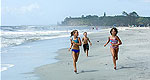
Blackbeard island is accessible only by boat. Transportation to the island is not provided by the Fish and Wildlife Service. Arrangements for trips to the refuge can be made at Shellman's Bluff. To reach Shellman's Bluff, travel south from Savannah on U.S. 17 for approximately 51 miles to Shellman Bluff Road which terminates at Shellman Bluff on the Julienton River. A public boat ramp on Harris Neck NWR (Barbour River Landing) may also be used as a launching site for trips to the island.
Description
Blackbeard Island was acquired by the Navy Department at public auction in 1800 as a source of live oak timber for ship building. In 1924 the island was placed under the jurisdiction of the Bureau of Biological Survey to be maintained as a preserve and breeding ground for native wildlife and migratory birds. A presidential proclamation in 1940 changed its designation from Blackbeard Island Reservation to Blackbeard Island National Wildlife Refuge. In 1975, three thousand acres of the refuge were set aside as National Wilderness. Blackbeard Island was named for Edward Teach, alias Balckbeard the Pirate. Rumors of Blackbeard's buried treasure still flourish, but no evidence of his fortune has ever been discovered.
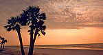
The island is comprised of interconnecting linear dunes thickly covered by oak/palmetto vegetation. There are approximately 1,163 acres of open freshwater or freshwater marsh, 2,000 acres of regularly flooded salt marsh, 2,115 acres of maritime forest, and 340 acres of sandy beach.
The primary objectives of the refuge are to provide wintering habitat and protection for migratory birds; provide protection and habitat to promote resident and migratory wildlife diversity; and to provide protection and management for endangered and threatened species (loggerhead sea turtle, American bald eagle, wood stork, piping plover). Notable concentrations of waterfowl, wading birds, shorebirds, songbirds, raptors, deer, and alligators can be seen at various times of the year.

