


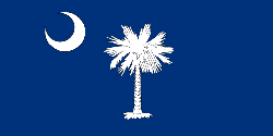
South Carolina
"Palmetto State"
- Motto
- Animis opibusque parati (Prepared in mind and resources) and Dum spiro spero (While I breathe, I hope)
- Capitol
- Columbia
- Name Origin
- In honor of Charles I of England
- Statehood Date
- May 23, 1788 (8th)
Cities in South Carolina
NOTE: Not all cities are displayed. Please narrow your selection by using the search above.
Official Symbols
A state's official symbols represent the composition and culture of the land and people who live and have lived here. Below are the symbols of South Carolina along with the year they became official.
| Flower | Carolina Yellow Jessamine (1924) |
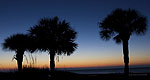
| Tree | Palmetto Tree (1939) |
| Bird | Carolina Wren (1948) |
| Song | “Carolina” (1911) |
Demographics
- Population Density
- 133.2 people per square mile
Geography and Weather
- Land Area
- 30,109 sq mi. (77,982 sq km)
- Lowest Elevation
- 0 ft (0 m)
- Average Elevation
- 350 ft (106.68 m)
- Highest Temperature Recorded
- 111°F (44°C) on June 28, 1954
- Lowest Temperature Recorded
- –19°F (–28°C) on January 21, 1985

